Trips Places Foods Stories Newsletters
Loading...
Loading...
Loading...
Loading...

No search results found for
“”

Make sure words are spelled correctly.

Try searching for a travel destination.

Places near me Random place

Popular Destinations

  • Paris
  • London
  • New York
  • Berlin
  • Rome
  • Los Angeles
Trips Places Foods Stories Newsletters
Sign In Join
Places near me Random place
All the United States Nevada Ophir

Ophir

A difficult trail leads to interesting ruins in a remote canyon in the Toiyabe Range.

Millett, Nevada

Added By
slgwv
Email
Been Here
Want to go
Added to list
CAPTION
Mill ruins.   slgwv / Atlas Obscura User
  slgwv / Atlas Obscura User
Dilapidated stone cabin.   slgwv / Atlas Obscura User
Roofless stone cabin.   slgwv / Atlas Obscura User
View of old store(?) from the west.   slgwv / Atlas Obscura User
Old commercial building, probably a store.   slgwv / Atlas Obscura User
Inside old building.   slgwv / Atlas Obscura User
Only walls left.   slgwv / Atlas Obscura User
Mill ruins with spoil heaps in the foreground.   slgwv / Atlas Obscura User
Spoil heaps below mill.   slgwv / Atlas Obscura User
Mill ruins.   slgwv / Atlas Obscura User
Mill ruin, close-up.   slgwv / Atlas Obscura User
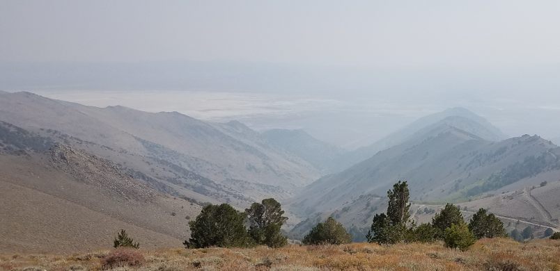
Looking east down Ophir Canyon from Ophir Summit. The Ophir townsite is between the prominent ridges on the right. The haze is smoke from wildfires in California.   slgwv / Atlas Obscura User
Interpretive sign on Nevada SR-376.   slgwv / Atlas Obscura User
Front of store.   slgwv / Atlas Obscura User
Well-preserved cabin.   slgwv / Atlas Obscura User
View back down Ophir Canyon from the mill site.   slgwv / Atlas Obscura User
Ruin above the mill site.   slgwv / Atlas Obscura User
Mill ruins.   slgwv / Atlas Obscura User
Portal of Murphy Mine.   slgwv / Atlas Obscura User
  slgwv / Atlas Obscura User
Looking across to the mill site from the portal to the Murphy Mine.   slgwv / Atlas Obscura User
Been Here
Want to go
Added to list

About

Silver was discovered in Ophir Canyon in the 1860s, but early mining efforts were defeated by the very hard rock which was unexpectedly expensive to drill and mill. After the discovery of a new orebody in the Murphy Mine, the only significant producer, a revival followed beginning in 1872 and lasting into the 1880s. However, activity had largely ceased by 1890 and the post office closed in 1893.

Ruins of the mill and a brick-and-stone building that was probably the store still can be seen, as well as several roofless stone cabins. The portal of the Murphy Mine itself remains open, although entering it is hazardous. Unfortunately, several years ago the Forest Service razed some of the remaining stone buildings as public hazards.

After the turn of the last century, there was only small-scale and intermittent activity on precious metal extraction. In the mid-20th century, however, tungsten deposits were discovered and worked near the canyon mouth. This lasted until the mid-1960s when the tungsten market collapsed due to the removal of the strategic-metal subsidies.

Little is left of the tungsten operations. A mill for tungsten to the south of the canyon mouth survived till the early 2010s but has since been torn down. A cemetery from the early days is preserved on the north side of the canyon mouth. 

Related Tags

Silver Nature Minerals Mines

Know Before You Go

The turnoff to Ophir is on the left 11.9 miles north of Carvers on Nevada State Route 376. It should be marked. From the turnoff it is about 2.6 miles to the canyon mouth on a dirt road, and high clearance probably will be required. From the mouth of the canyon it's another 2.2 miles up to the ruins at Ophir, along Ophir Canyon, and 4wd and high clearance are mandatory on this stretch. Indeed, a short-coupled vehicle is desirable. The trail is also barely wide enough for a standard-sized vehicle, so wide vehicles are likely to encounter difficulties.

The trail continues on up the canyon past the ruins and indeed crosses the Toiyabe Range at Ophir Summit. This section will be blocked by snow until the summer months, and in any case much of it consists of a steep, narrow shelf road on which there are few places for oncoming traffic to pass. It should be attempted only by experienced off-road drivers with adequate vehicles.

Community Contributors

Added By

slgwv

Published

June 16, 2023

Edit this listing

Make an Edit
Add Photos
Sources
  • Stanley W. Paher, Nevada Ghost Towns and Mining Camps, Nevada Publications, Las Vegas, 1970, p. 372-374.
Ophir
Millett, Nevada, 89045
United States
38.942171, -117.260234

Nearby Places

Berlin-Ichthyosaur State Park

Austin, Nevada

miles away

Toiyabe Crest Trail

Austin, Nevada

miles away

Toquima Cave

Austin, Nevada

miles away

Explore the Destination Guide

Photo of Nevada

Nevada

United States

Places 265
Stories 24

Nearby Places

Berlin-Ichthyosaur State Park

Austin, Nevada

miles away

Toiyabe Crest Trail

Austin, Nevada

miles away

Toquima Cave

Austin, Nevada

miles away

Explore the Destination Guide

Photo of Nevada

Nevada

United States

Places 265
Stories 24

Related Places

  • Aerial view easterly over the mine site. The main pit is just right of center.  The freeway is Interstate-15.

    Mountain Pass, California

    Mountain Pass Mine

    The only mine for rare earth elements in the United States has been intermittently active since the 1950s.

  • Living quarters

    Aouli, Morocco

    Ahouli Mines

    Large-scale operations in these mines ceased in the 1960s, leaving behind crumbling processing facilities and deserted living quarters.

  • Entrance to the Peak District Mining Museum

    Matlock Bath, England

    Peak District Lead Mining Museum

    Explore the history of mining in this museum, or in a real mine from the 1920s.

  • After extensive renovations in the 1990s, the mine was opened to the public.

    Scotia, Nebraska

    Happy Jack Chalk Mine

    After sitting abandoned for decades, this historic mine is now the only publicly accessible chalk room and pillar mine in North America.

  • Lagoon in Carnglaze Caverns

    St Neot, England

    Carnglaze Caverns

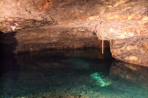
    A haunted slate mine turned concert hall and a hidden fairy garden.

  • Beach at Basin Head

    Souris, Prince Edward Island

    Singing Sands Beach

    A walk along this white sand beach creates a symphony.

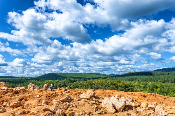
  • The Coleman Mine is part of the region’s extensive “quartz belt,” a 30-40-mile wide and 170-mile-long band of quartz found in the Ouachita Mountains.

    Jessieville, Arkansas

    Coleman Mine

    Crystal hunters can dig for their own stones at this DIY mine in Arkansas’ quartz belt.

  • View over the quartz outcrops.

    Verdi, California

    Crystal Mine

    A mine in the Sierra Nevada that produced nothing but barren quartz.

Aerial image of Vietnam, displaying the picturesque rice terraces, characterized by their layered, verdant fields.
Atlas Obscura Membership

Become an Atlas Obscura Member


Join our community of curious explorers.

Become a Member

Get Our Email Newsletter

Follow Us

Facebook YouTube TikTok Instagram Pinterest RSS Feed

Get the app

Download the App
Download on the Apple App Store Get it on Google Play
  • All Places
  • Latest Places
  • Most Popular
  • Places to Eat
  • Random
  • Nearby
  • Add a Place
  • Stories
  • Food & Drink
  • Itineraries
  • Lists
  • Video
  • Podcast
  • Newsletters
  • All Trips
  • Family Trip
  • Food & Drink
  • History & Culture
  • Wildlife & Nature
  • FAQ
  • Membership
  • Feedback & Ideas
  • Community Guidelines
  • Product Blog
  • Unique Gifts
  • Work With Us
  • About
  • FAQ
  • Advertise With Us
  • Advertising Guidelines
  • Privacy Policy
  • Cookie Policy
  • Terms of Use
Atlas Obscura

© 2025 Atlas Obscura. All Rights Reserved.