AO Edited
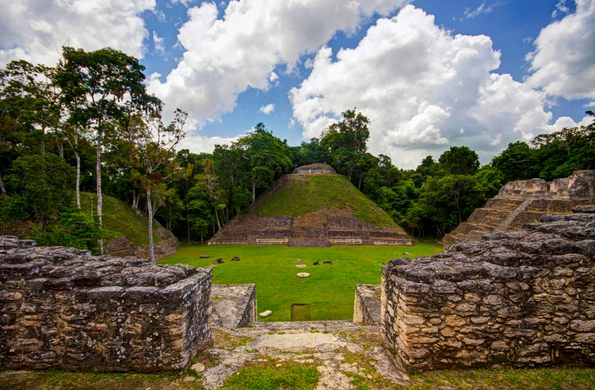
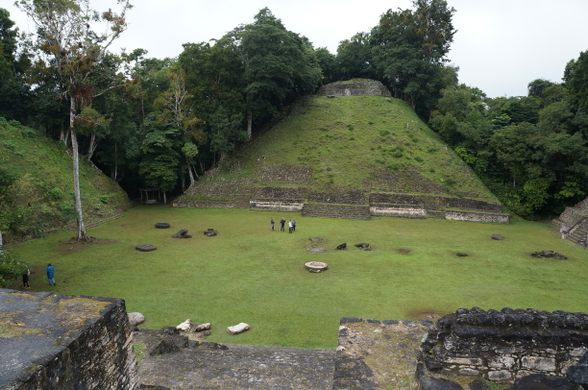
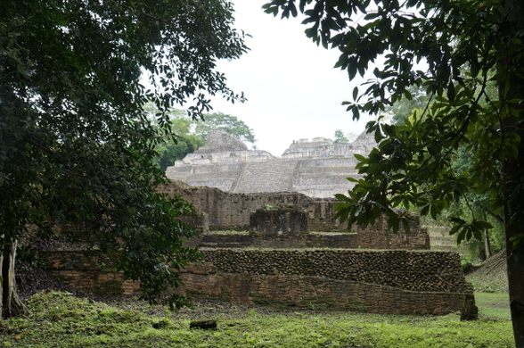
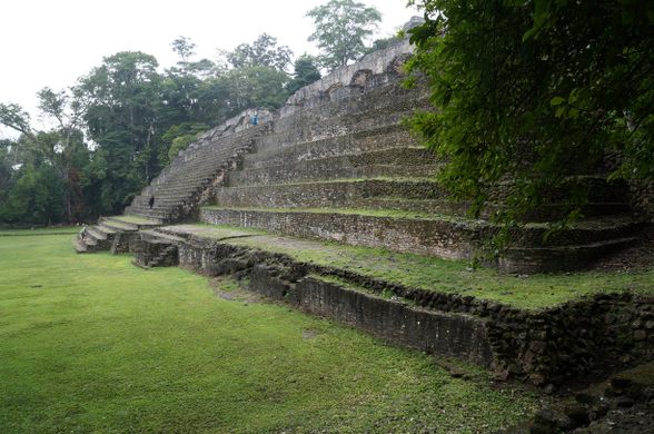
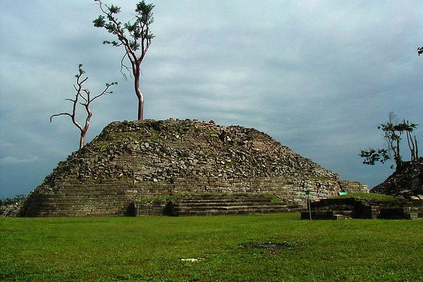
Caracol
This massive Maya archaeological site is home to the tallest man-made structure in Belize.

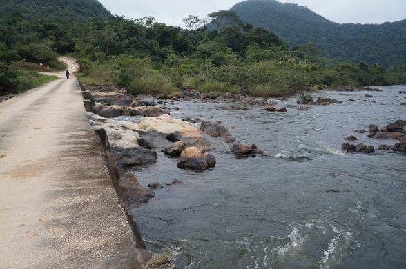
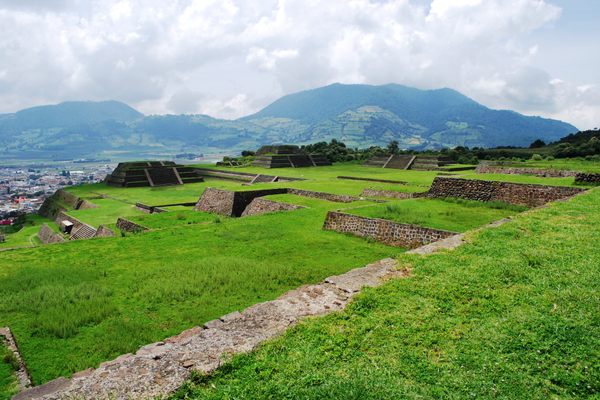
The road begins near San Ignacio, a rugged town in western Belize not far from the Guatemalan border. About three hours down a winding, muddy jungle road and you’ll enter the site of Caracol, a vast, ancient Mayan city that thrived for 300 years and, at its peak, covered nearly 77 square miles (200 sq km)—larger than Belize City today.
Even at its busiest, you won’t find crowds of tourists at Caracol. Although it is located only about 50 miles (75 km) from Tikal, the site at Caracol remains less visited, perhaps due to its relative inaccessibility and more recent archaeological interest.
Caracol was rediscovered in 1937, when a native logger named Rosa Mai came across its remains while searching for mahogany in the area. The site was surveyed the following year, but more significant investigation did not begin until 1985, when the Caracol Archaeological Project was established.
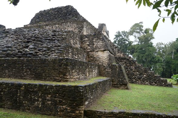
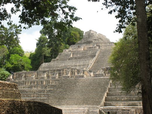
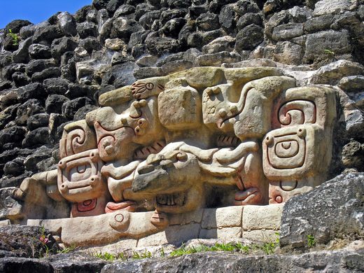
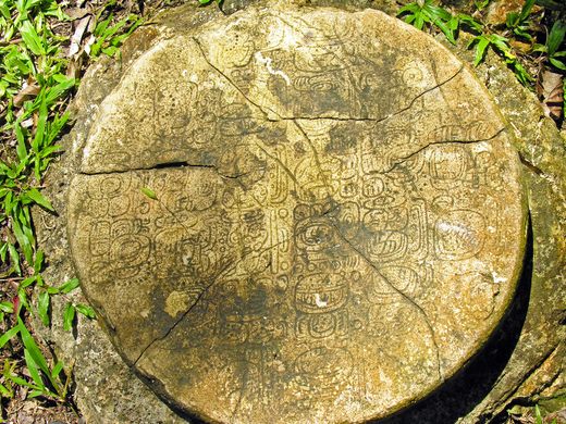
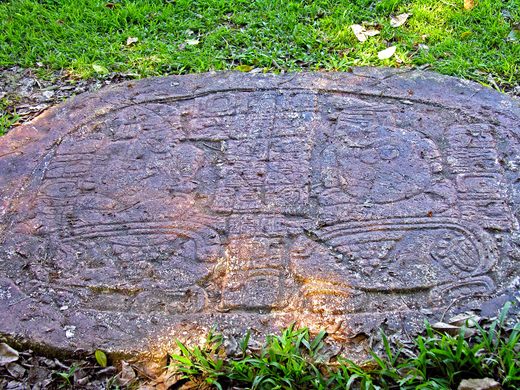
The site—which is only partially uncovered—includes several plazas, acropolises, and residential areas, along with many altars and stelae. More than 250 burials and 200 caches have been discovered at the site so far. The largest building, Caana (“sky palace”), remains the tallest human-made structure in Belize at 141 feet tall (43 m).
Archaeological evidence suggests that Caracol was an important Maya site that was occupied continuously from 600 B.C. to 1100 A.D. The city was at its largest and densest during the Late Classic Period, around 650. At its height, the population of Caracol is thought to be around 100,000 or more, easily exceeding Tikal’s peak population. But 300-400 years later, the central metropolis was mostly abandoned.
The name Caracol means “snail,” apparently in reference to the twisted road used to approach the site.
Know Before You Go
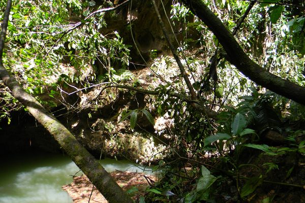
The only way to get to Caracol is the single access road. Tour buses leave from San Ignacio, or you can drive yourself. Make sure your vehicle has good ground clearance and suitable tires. Do not attempt to drive this road in the rainy season (July-December) without first inquiring locally. Drivers must stop at two checkpoints. Drivers are also required to stop at the Douglas Da Silva Forest Station at about the halfway point, where an armed escort will lead you the rest of the way. (Inquire at San Ignacio to verify that this is still the case; you may be required to meet the escort at a certain time.) Bring your own picnic lunch and water, as there are no provisions on the site or anywhere along the way. There are several scenic spots along the route, most notably the Rio On Pools and the Rio Frio Cave.


Follow us on Twitter to get the latest on the world's hidden wonders.
Like us on Facebook to get the latest on the world's hidden wonders.
Follow us on Twitter Like us on Facebook