Haunted Vista
A rock maze opens up to a panoramic viewpoint at an abandoned mine full of ghost stories.


The Anna S. underground mine on Rattler Mountain opened in 1905. It was set apart from the owner’s other mines across the deep Wilson Creek Valley. Rather than use a rival’s nearby inclined plane, a cable line, somewhat resembling a ski mountain chair lift, was built across the valley to carry coal by the bucketload to the friendly depot.
The dramatic viewpoint from this apparatus gave birth to a local folk legend. It’s been said that from the top of Rattler Mountain, you can see the ghosts of workers who died carrying coal across the valley.
Although neither mine records nor local historians can definitively identify anyone who died crossing the valley, the Pennsylvania State Archives show deaths due to mule accidents and rock falls in the Anna S. mine. The cable line ran until the Great Depression claimed the operation in 1937. Decades later, another company started surface mining around the old underground mine, and yet again, ghost stories emerged. In the late 1970s, men working the night shift reported seeing the ghost of dead miners climbing out of the mine shaft with lamps and picks.
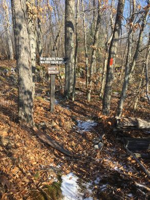
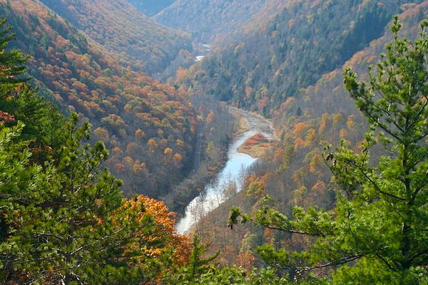
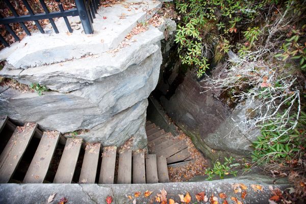
Today, part of Pennsylvania’s longest hiking trail, the Mid State Trail (MST), leads to the haunted panorama over the old mining town. From a parking area on Route 287, a yellow blazed trail climbs the hill. For a more adventurous hike, turn left where the vista sign says to turn right onto another yellow blazed path to climb some more, then near the top fork left at a sign Rock Bypass both ways, once again to come on to turn right on the orange marked MST proper, at a sign for “Rock Bypass.” The less adventurous can turn right here, going around a rock maze. The main trail continues ahead, inviting hikers to step over 10-foot-deep crevasses in the rock. Soon, another trail diverges, dropping down into the maze where you can wander through narrow passages as others step across the voids above.
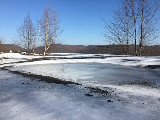
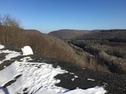
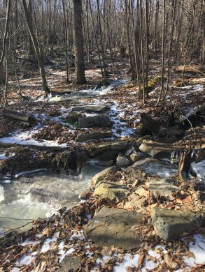
The trails come back together to cross a ghostly white creek on large stepping stones. (The white, slippery aluminum hydroxide in this water is a byproduct of the cleaned and treated acid water that once flowed from the old mines.) After the creek, another junction with the other branch of the yellow trail, a more direct return to the Rt 287 parking. After passing a foundation from the old bucket tram, two miles in from the parking spot, a panoramic view opens up revealing miles of woods and a distant view of the old mining town of Antrim atop the mountain across the valley. At your feet, a pile of black shale extends 400 feet down to the creek below. Though the miners’ spirits may or may not visit you, the waste they left behind subtly haunts the landscape.
Turn your back on the view, climb the hill, and turn left on an old road, and you’ll see the entrance to the old underground mine on the left. State forestry folks partially blocked the entrance to retain the acid water to be treated, and to keep out too-curious explorers, but a large pipe remains so bats can come out at night. To return to parking, retrace your steps on the trail you came in on until just past the big bucket Tran foundation, turn left to descend the hill more steeply and directly, passing a smaller foundation for an intermediate tram tower on the way down, and a different crossing of the ghostly creek. Or, hike on north towards New York State, descending and climbing the valley, wishing you could ride over.
Know Before You Go
The way in described here starts on a gravel road that may be hard to follow in winter. The map coordinates listed are to a grassy parking spot in Tioga State Forest. The paths described here are on public land. Do not try to park on Anna S Road to the north and trespass on nearby private land. There is free trail map of area, Section 17 of Mid State Trail.
Duncan Tavern, a local watering hole in the old company store in Antrim, offers good bar food and has historical photos on the walls. Nearby Wellsboro has several hotels and restaurants in its cute, genuinely gas-lit downtown.


Follow us on Twitter to get the latest on the world's hidden wonders.
Like us on Facebook to get the latest on the world's hidden wonders.
Follow us on Twitter Like us on Facebook