Kronshtadt Sea Gauge
This historic system is the zero level benchmark for measuring the depths and altitudes of the Baltic.


The town of Kronstadt is part of an old naval fortress outside Saint Petersburg that was once the city’s main seaport. For centuries the sea level town has been prone to flooding by the quick-changing water levels of the Gulf of Finland.
Beginning in the late 18th century, a sea gauge was built to monitor these fluctuations in the sea level, and it is still the zero-point benchmark for measuring the water levels of the Baltic Sea, as well as altitudes throughout the region. In the Soviet era, this reference point was even used to measure the orbits of spacecraft.
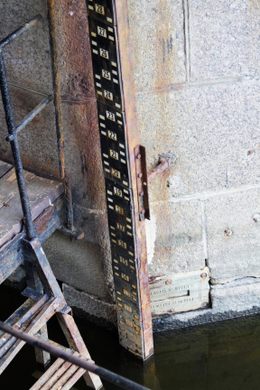
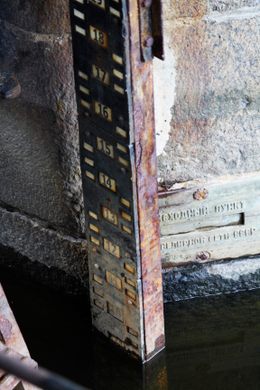
Water levels across much of Europe today are measured based on the zero level of the Amsterdam Ordnance Datum. But not so in Russia, which still uses the historic Kronstadt sea gauge. The original tool, a metal rod with marks, was used to measure sea levels until the late 1800s, when it was replaced by an updated method, a floating tide gauge instrument called a mareograph.
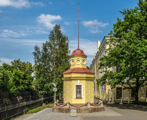
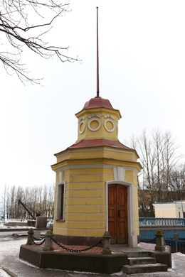
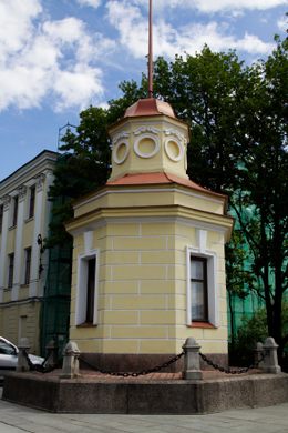
The tide gauge floats within a deep well housed inside a small yellow wooden pavilion near the Blue Bridge. The original rod is still in place, however, affixed to a pillar under the bridge. Its visible marks are a fascinating historic record of the changing Baltic Sea.
Know Before You Go
The pavilion is located near the former Italian palace, next to the Blue Bridge across the Obvodny Canal. The wooden pavilion seen today is a reconstruction of the original, restored in the mid 20th century.


Follow us on Twitter to get the latest on the world's hidden wonders.
Like us on Facebook to get the latest on the world's hidden wonders.
Follow us on Twitter Like us on Facebook