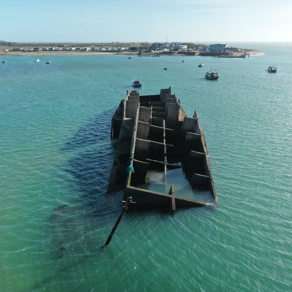
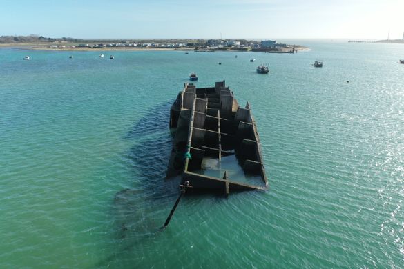
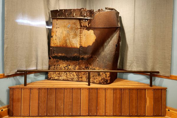
Mulberry Harbour Wreck
This concrete monster of a wreck lies in the mouth of Langstone Harbour as a monument to the incredible history of D-Day.

The D-Day landings went down in history, but without a sufficient port to offload all the supplies for the entire Western Front onto, the invasion of Normandy would be short-lived. The answer to this problem was to build a temporary, but giant floating harbour of concrete and steel, named Mulberry Harbour. The United Kingdom got to work constructing the Mulberry Harbours before floating them across to France secretly just before D-Day. Two Mulberry Harbours (the first at Omaha Beach and the second at Gold Beach) were used to offload 2.5 million troops, 500,000 vehicles, and 4 million tons of supplies for the Allied forces. An incredible feat for a temporary floating structure.
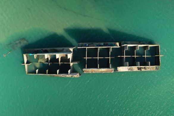
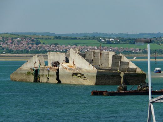
Hayling Island was the location responsible for constructing sections of the Mulberry Harbours, called a Phoenix Caisson. These giant segments were made up of chambers that allowed them to be floated and scuttled at command. Many Mulberry Harbours sections were scuttled near their construction site until they were called upon, then refloated and deployed where required. Many of these Phoenix Caissons still exist to this day, mainly on the French coast, but several can still be found around the British coastline.
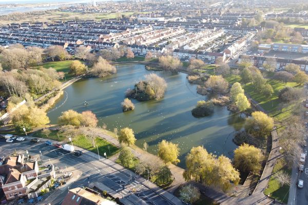
One of the Phoenix Caissons constructed on Hayling Island developed a crack in its hull whilst waiting for deployment. It sank in Langstone Harbour before it was briefly re-floated and moved further offshore, as it was a hazard to shipping. There, it was scuttled one last time with the plan to repair the caisson later, however, the plan never came to fruition and the hulk was left in the water. There was a plan in the 1960s for the wreckage to be refloated and all the steel onboard recycled, however, this plan never saw the light of day and over time, exposed to the sea, the caisson broke its back, officially sinking any hopes of salvaging the wreck.The wreck is visible at all times of the year just to the North of the Hayling Island Landing. Some adventurers have rowed, paddled and even swam out to the wreckage (beware that last one, currents in the harbor are strong), to get a close up look at history.
Know Before You Go
The wreck is easily viewable at the end of Ferry Road. There is a pay and display car park and a couple of cafes where you can grab a bite to eat, enjoy the area and read a few boards which display information about the wartime history of Hayling Island.
It's fairly common for people to row out to the wreckage, although the structure is purely concrete and can be dangerous to climb up onto. Be aware of currents at all times, as the Solent is notorious for strong tides.
Try to go at low tide and make sure you explore the area around the end of Hayling Island, a lot of concrete blocks and rails from the former construction site are still visible.


Follow us on Twitter to get the latest on the world's hidden wonders.
Like us on Facebook to get the latest on the world's hidden wonders.
Follow us on Twitter Like us on Facebook