Trips Places Foods Stories Newsletters
Loading...
Loading...
Loading...
Loading...

No search results found for
“”

Make sure words are spelled correctly.

Try searching for a travel destination.

Places near me Random place

Popular Destinations

  • Paris
  • London
  • New York
  • Berlin
  • Rome
  • Los Angeles
Trips Places Foods Stories Newsletters
Sign In Join
Places near me Random place
All the United States Colorado Penrose Phantom Canyon Road

Phantom Canyon Road

The narrow mountain road that carves a path between Florence and Victor is tied to ghost towns and ghost stories.

Penrose, Colorado

Added By
Evan Bonham
Email
Been Here
Want to go
Added to list
CAPTION
  Matt Pierce | Getty Images
Phantom Canyon Road   er1ca / Atlas Obscura User
Been Here
Want to go
Added to list

About

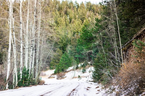
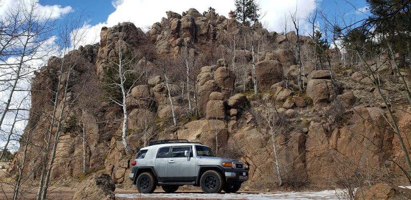
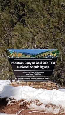
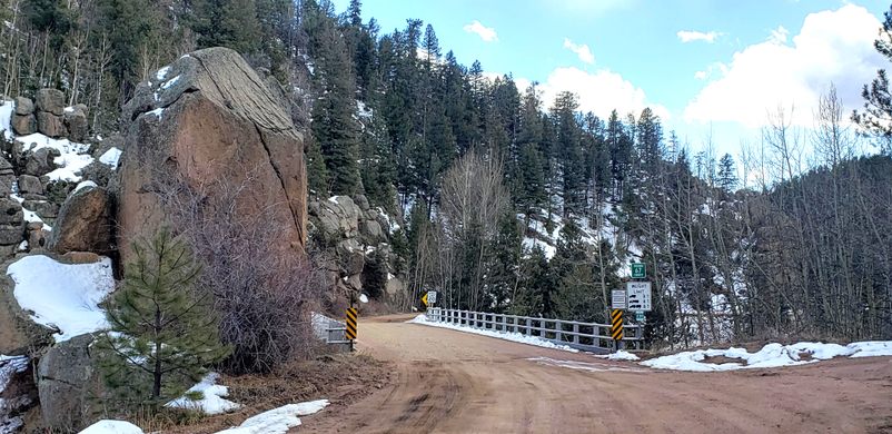
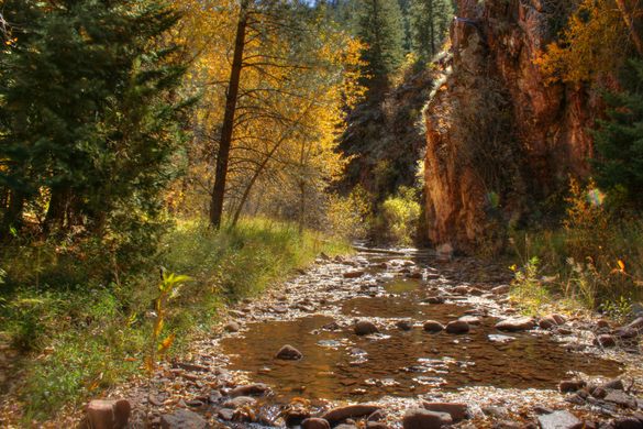
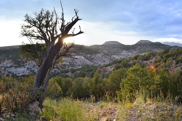
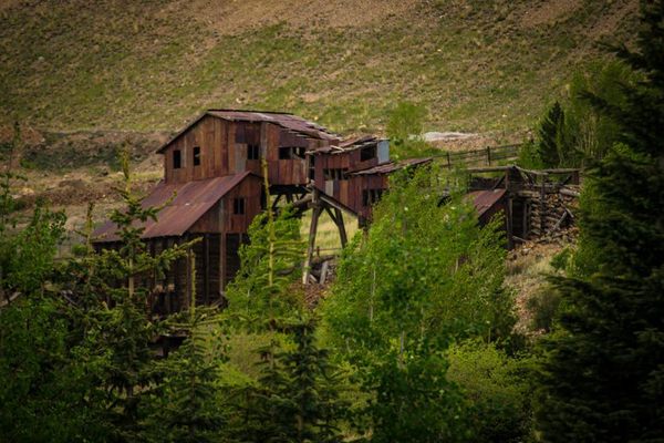
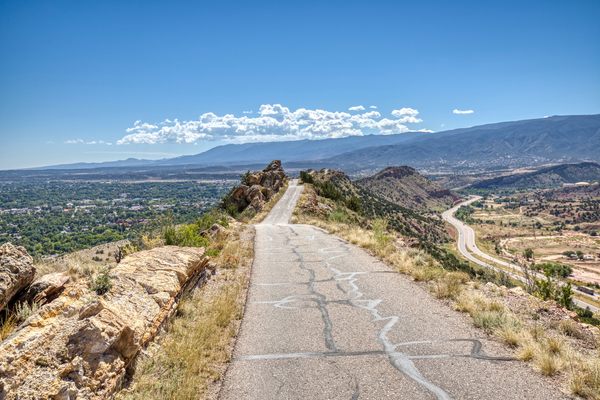
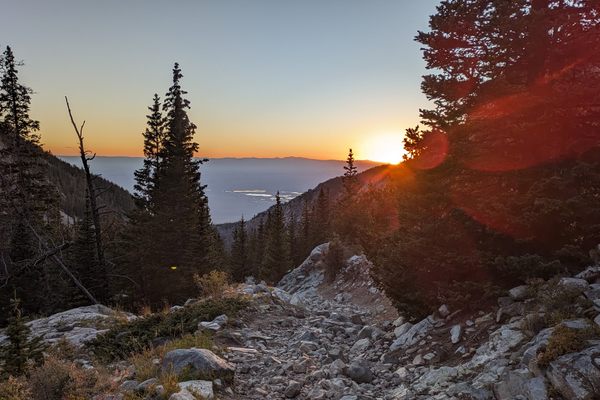
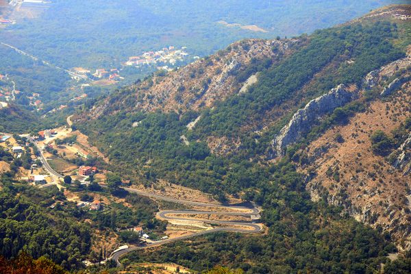
How places get their names is often subject to debate, their actual origins lost over time. But when it comes to Phantom Canyon Road, the difference can mean an experience that’s steeped in western history complete with its ghost towns, or an experience with a ghost of a different, more literal kind. Whatever the “true” story may be, one thing that’s not up for debate is the road connecting the former mining districts of Cripple Creek, Cañon City and Florence is a scenic detour that climbs 9,500 feet to reveal some of the state’s most secluded natural views. 

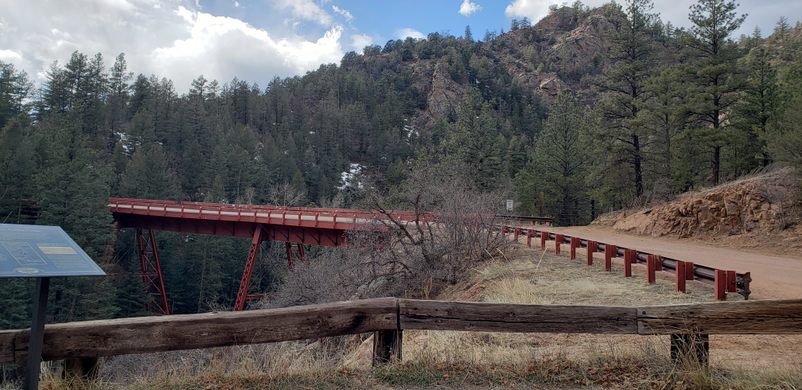
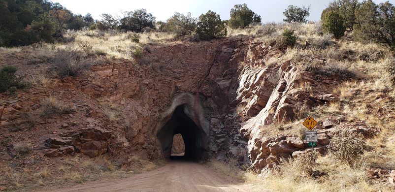
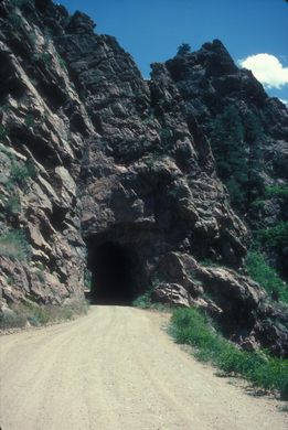
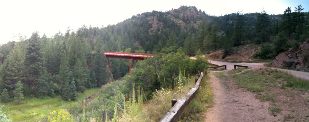
The road full of twists and turns began as the Florence and Cripple Creek Railroad, a narrow-gauge railroad that was built in 1894. WIth narrower-than-standard track widths, these types of railways were designed to handle a mountain’s sharp curves. When the mining boom first hit the region, the only way to these mining districts was with horse-drawn wagons over rough roads. Some 1,200 workers were hired to construct the railway, difficult work that often meant blasting through rock. Over just six months, the crew built over 40 miles of track including two tunnels and several bridges. (Only Adelaide Bridge, which spans Eightmile Creek, remains today.)

The railway suffered accidents almost immediately. Just one day after opening a train derailed, resulting in a death. Weather woes plagued the line, and washouts were a regular occurrence. As mining operations grew in nearby Colorado Springs, which had a larger, standard-gauge line that allowed for a shorter trip, the Florence and Cripple Creek Railroad’s business declined. Its final hours came on July 21, 1912, when a flood washed out 12 bridges, five miles of track, and several towns in the area. 

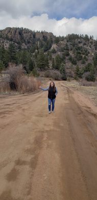
The tracks were eventually removed, and in 1918, the former railway was converted to a public road. Today, drivers can experience the hairpin turns and steep drop-offs on the 30-mile road that the train once ran along. 

The towns, and the spaces they left behind, may have been the source of the Phantom Canyon name. The other possibility comes from an urban legend from the 1890s. Train passengers reported seeing a man walking along the tracks. The only problem? That man had been executed at the state prison a few days earlier. Whether or not the road is haunted will be a mystery for the ages, but for now, slow down and enjoy the ride.

Related Tags

Roads

Know Before You Go

With its sharp turns and unguarded drop-offs, this unpaved road requires a slow pace to enjoy it safely. Only standard vehicles without trailers are allowed.

Community Contributors

Added By

evanbonham

Edited By

er1ca

  • er1ca

Published

December 15, 2021

Edit this listing

Make an Edit
Add Photos
Sources
  • https://www.goldbeltbyway.com/map-guide/phantom-canyon-road
  • https://www.outtherecolorado.com/adventures/the-canyon-filled-with-phantoms/article_d342bb8f-42b8-5de8-80ef-8727521b582c.html
  • https://www.colorado.com/articles/colorado-hidden-gem-phantom-canyon-road
  • https://www.jstor.org/stable/40167621 “A Colorado Short Line Railroad: The Florence and Cripple Creek 1894-1915”
  • https://museum.canoncity.org/?p=2315
Phantom Canyon Road
Phantom Canyon Rd
Penrose, Colorado, 81240
United States
38.581881, -105.118025
Get Directions

Nearby Places

Garden Park Fossil Area

Cañon City, Colorado

miles away

Black Monarch Hotel

Victor, Colorado

miles away

Vindicator Valley Trail

Cripple Creek, Colorado

miles away

Explore the Destination Guide

Photo of Colorado

Colorado

United States

Places 308
Stories 29

Nearby Places

Garden Park Fossil Area

Cañon City, Colorado

miles away

Black Monarch Hotel

Victor, Colorado

miles away

Vindicator Valley Trail

Cripple Creek, Colorado

miles away

Explore the Destination Guide

Photo of Colorado

Colorado

United States

Places 308
Stories 29

Related Stories and Lists

14 Precarious Roadways

List

By Jonathan Carey

Related Places

  • Rotterdam, Netherlands

    Street Posts Museum

    An unexpected public exhibit showcases the diversity of Dutch street posts.

  • The main gate of Chōshō-ji Temple, built in 1629.

    Hirosaki, Japan

    Zenringai (Zen Temple Street)

    These 33 Zen Buddhist temples were built to protect the nearby castle.

  • Watch out for serious curves ahead.

    San Francisco, California

    Vermont Street

    Lombard Street may be more famous, but this is the real “crookedest street in the world.”

  • Come journey into the feudal past.

    Hakone, Japan

    Old Tokaido Way

    The centuries-old cobblestones of a feudal highway remain in the woods of Hakone.

  • Heritage Street.

    Henderson, Nevada

    Heritage Street

    Clark County Museum has created an entire street of historically important buildings relocated from various other locations within the county.

  • A large reclining Buddha is carved into sandstone along the side of the Thakhek Loop.

    Khamkeuth, Laos

    Sandstone Buddha Sculptures

    Giant Buddhas carved into sandstone walls line this Laotian motorbike route.

  • Looking down Lake Como road at sunset

    Blanca, Colorado

    Lake Como Road

    The worst road in Colorado is the main gateway to some of its highest peaks.

  • Brussels, Belgium

    Largest Paving Stone in Belgium

    This huge limestone slab is considered the largest paving stone in Belgium and a relic of the earliest modern paving in Brussels.

Aerial image of Vietnam, displaying the picturesque rice terraces, characterized by their layered, verdant fields.
Atlas Obscura Membership

Become an Atlas Obscura Member


Join our community of curious explorers.

Become a Member

Get Our Email Newsletter

Follow Us

Facebook YouTube TikTok Instagram Pinterest RSS Feed

Get the app

Download the App
Download on the Apple App Store Get it on Google Play
  • All Places
  • Latest Places
  • Most Popular
  • Places to Eat
  • Random
  • Nearby
  • Add a Place
  • Stories
  • Food & Drink
  • Itineraries
  • Lists
  • Video
  • Podcast
  • Newsletters
  • All Trips
  • Family Trip
  • Food & Drink
  • History & Culture
  • Wildlife & Nature
  • FAQ
  • Membership
  • Feedback & Ideas
  • Community Guidelines
  • Product Blog
  • Unique Gifts
  • Work With Us
  • About
  • FAQ
  • Advertise With Us
  • Advertising Guidelines
  • Privacy Policy
  • Cookie Policy
  • Terms of Use
Atlas Obscura

© 2025 Atlas Obscura. All Rights Reserved.