Sandy Island
This phantom island appeared on maps for over a century before amateur radio enthusiasts beat Google Earth to the punch in its "undiscovery."
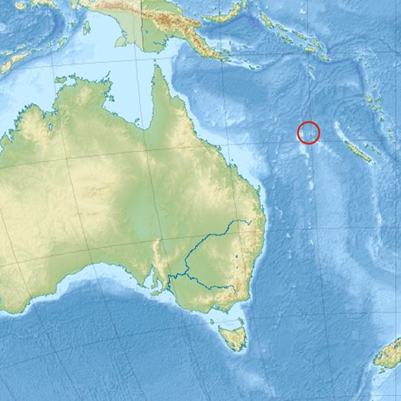
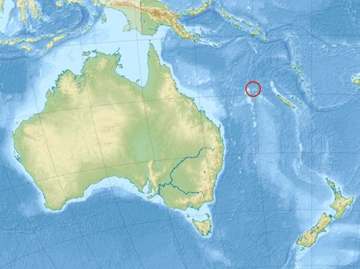
At almost double the size of Manhattan, it’s downright baffling that it took until 2012—decades after satellite imaging was commonplace and Google Earth had risen to prominence—for anyone to notice not only was Sandy Island not where it was supposed to be… but it didn’t exist at all.
In fact, no one is entirely sure how Sandy Island made its way on to maps and nautical charts in the first place. The idea of it being a maritime equivalent of a trap street is unlikely given the centuries-old history of Sandy Island. But in the Coral Sea, where atolls lurk and shift only inches below the water’s surface, a lack of evidence does not necessarily mean something isn’t present.
The confusion may have begun early on, with a voyage made by Captain James Cook in 1776, when Cook reported a “sandy island” in his logs in the general vicinity of the place Sandy Island would come to rest on maps for the next 200 years. According to a few maps dated in the late 1800’s, the official “discovery” of Sandy Island proper at its erstwhile permanent coordinates is attributed to the whaling ship Velocity in the year 1876.
For over a century, the phantom island would continue its dominion at sea on paper alone, with ships avoiding the nonexistent threat of its frothy shores. Beginning in the 20th century, the symbol “ED” (signifying “existence doubtful”) began appearing next to the island on hydrographic charts after failures to spot the island began trickling in to cartographic societies.
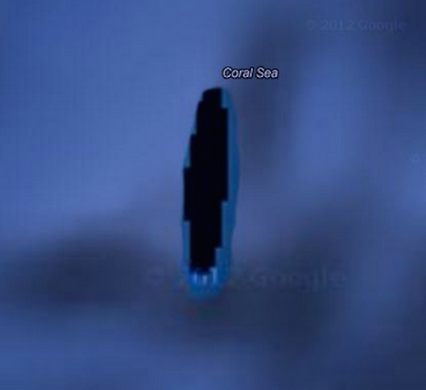
Then in 2000, amateur radio enthusiasts on a DX-pedition (jaunts whose mission hinge on traveling to exotic locales where radio isn’t prevalent) exposed Sandy Island for the fraud that it had always been. Upon arriving, they found they had no destination upon which to make landfall.
Once the general public had proven what navigators had suspected but surveyors and Google Earth had ignored, the mystery of Sandy Island crumbled quickly. Australian scientists studying plate tectonics verified that at the coordinates of Sandy Island, the ocean floor never became “shallower than 1,300 meters below the wave base,” making an island’s existence simply impossible.
On November 29, 2012, the National Geographic Society announced it had seen all it needed to, and the island would be stricken from its maps henceforth. Sandy Island officially had been returned to the oblivion from whence it came.


Follow us on Twitter to get the latest on the world's hidden wonders.
Like us on Facebook to get the latest on the world's hidden wonders.
Follow us on Twitter Like us on Facebook