Trips Places Foods Stories Newsletters
Loading...
Loading...
Loading...
Loading...

No search results found for
“”

Make sure words are spelled correctly.

Try searching for a travel destination.

Places near me Random place

Popular Destinations

  • Paris
  • London
  • New York
  • Berlin
  • Rome
  • Los Angeles
Trips Places Foods Stories Newsletters
Sign In Join
Places near me Random place
All the United States Arizona Dateland Sears Point Petroglyphs
AO Edited

Sears Point Petroglyphs

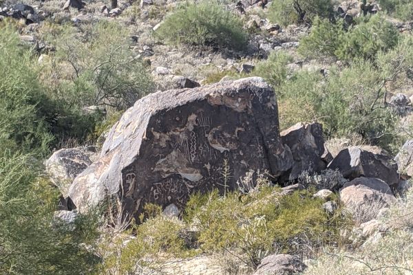
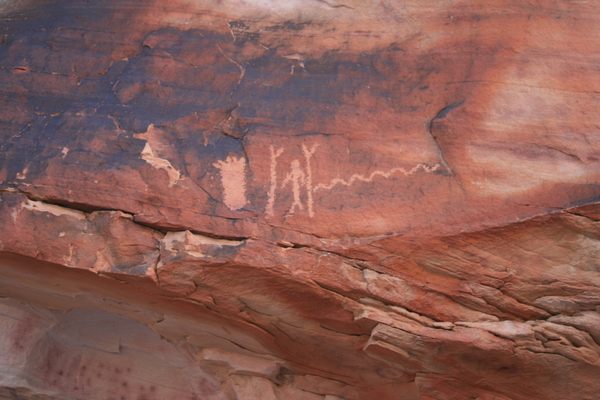
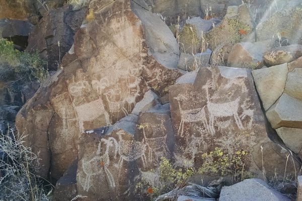
Some 10,000 works of ancient rock art cover these volcanic basalt outcrops near the Gila River.

Dateland, Arizona

Added By
Joe Baldwin
Email
Been Here
Want to go
Added to list
CAPTION
Petroglyphs at Sears Point   Deborah Lee Soltesz/Public Domain
Medusa decorated staff petroglyph   Deborah Lee Soltesz/Public Domain
Drawing of an animal   Deborah Lee Soltesz/Public Domain
  Bureau of Land Management / Public Domain
Parking   jbaldwin0928 / Atlas Obscura User
Cliffs   jbaldwin0928 / Atlas Obscura User
Petroglyphs at Sears Point   Deborah Lee Soltesz/Public Domain
Petroglyphs at Sears Point   Bureau of Land Management / Public Domain
Roads   jbaldwin0928 / Atlas Obscura User
  Bureau of Land Management / Public Domain
Been Here
Want to go
Added to list

About

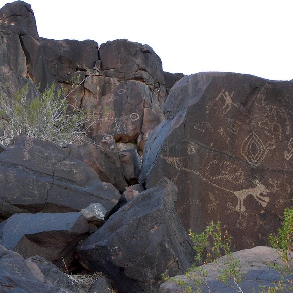
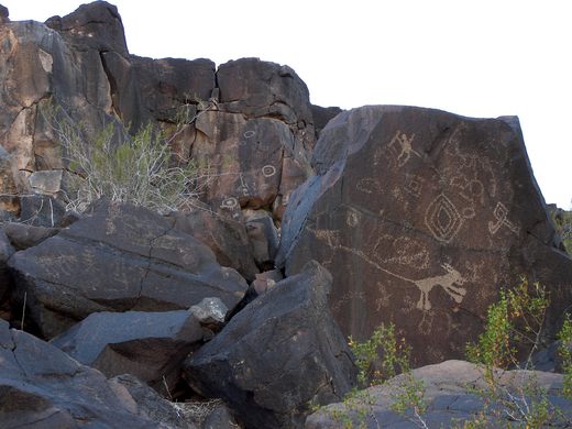
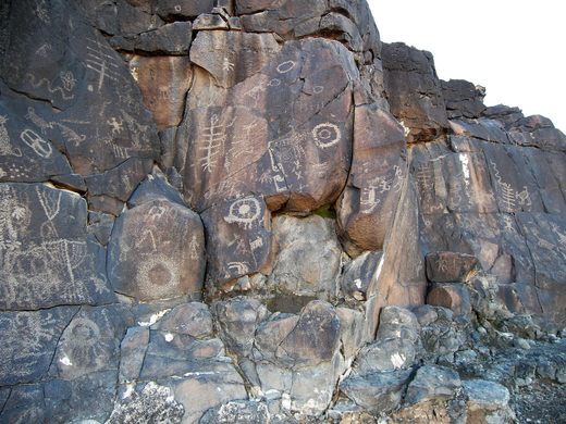
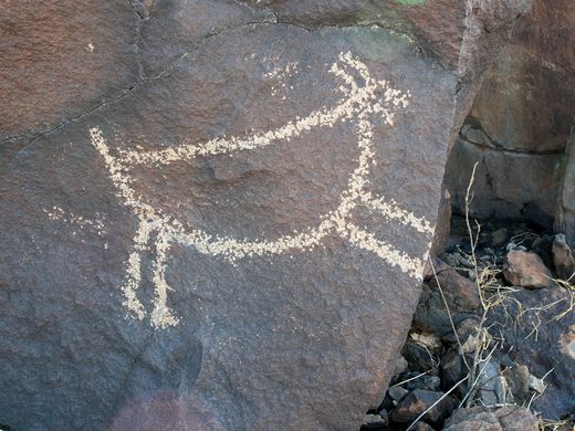
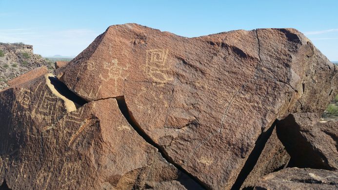
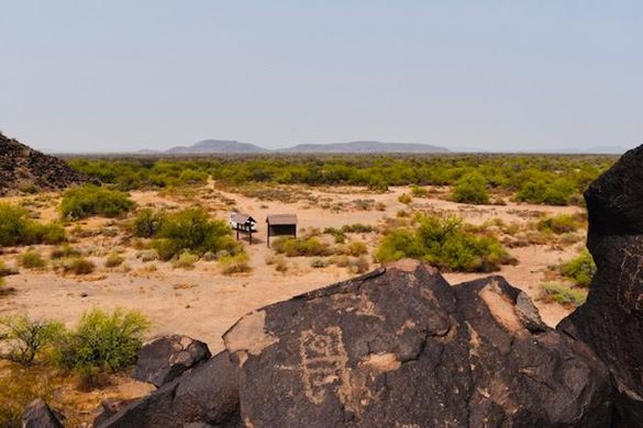
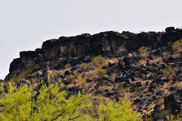
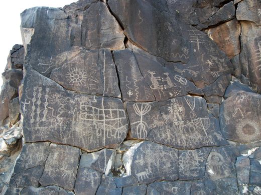
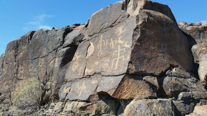
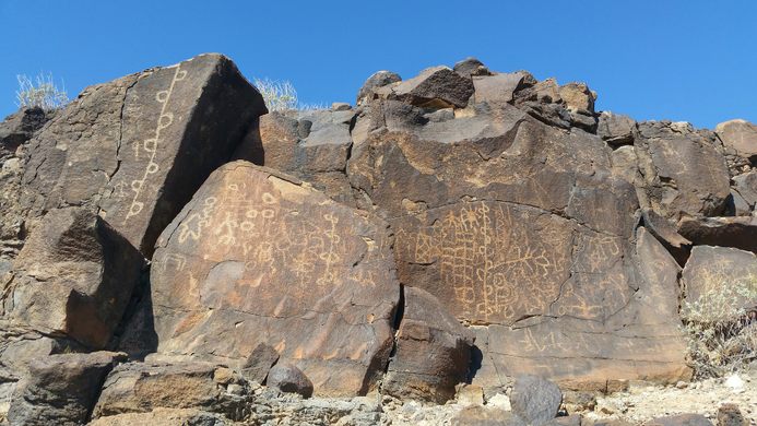
At Sears Point, near the Gila River in Arizona, around two miles of basalt cliff edges are filled with ancient art. There are more than 2,000 panels of rock art, with an estimated 10,000 petroglyphs elements. The area also contains a number of geoglyphs and other features of archaeological interest.

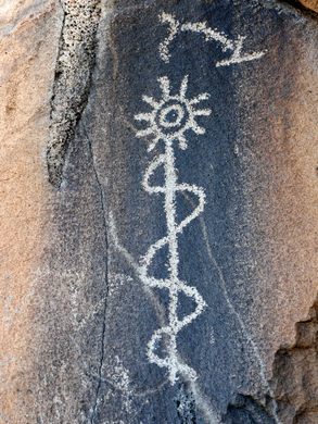
Archaeologists consider Sears Point one of the most significant collections of rock art in the American Southwest. This is due to the sheer density of petroglyphs, as well as the unique style of art. Many of the petroglyphs have been attributed to the Patayan culture tradition. Many different design elements are visible on these panels, including curvilinear, rectilinear, anthropomorphic, zoomorphic, abstract, and stylistic figures. In some places, flat basalt rocks were used for petroglyphs to mark trails. Several major petroglyph panels may be associated with Native American myths and legends. This area around Sears Point has been utilized for centuries by many cultures. Today, there are 15 tribes that claim cultural affiliation with the area.

The Sears Point area also features examples of historic graffiti. Names and dates carved into the rock have been affiliated with early trappers, "49er" gold rush groups, and settlers who passed through the area between 1840 and 1900.

The area embraces a wide array of archaeological sites, including rock alignments, cleared areas, intaglios, petroglyphs, and aboriginal foot trails. The Arizona BLM has designated Sears Point an Area of Critical Environmental Concern, where special attention is required to protect and prevent damage to the site.

Related Tags

Petroglyphs Cliffs Archaeology Indigenous Trails Native Americans

Know Before You Go

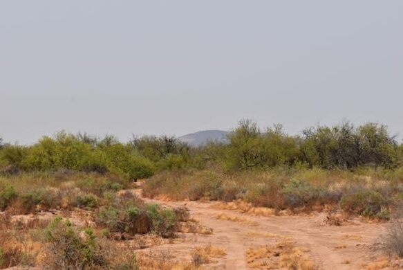
Park in the cleared area in front of the ridge, without passing the carsonite posts. The dirt road is not maintained by BLM, and is very rough. It can be muddy and dangerous after rain.  Take plenty of water, be aware of bees and snakes. 

There are a couple of ways you can go. Multiple peaks with hundreds and hundreds of ancient petroglyphs. The panels are visible from the trailhead.

Community Contributors

Added By

jbaldwin0928

Edited By

Michelle Cassidy

  • Michelle Cassidy

Published

May 4, 2021

Edit this listing

Make an Edit
Add Photos
Sources
  • https://www.blm.gov/visit/sears-point
  • https://rscottjones.com/sears-point-petroglyph-site/
  • http://www.rupestrian.com/Sears_Point_IFRAO2013.pdf
  • https://www.oldpueblo.org/event/sears-point-and-painted-rocks-petroglyphs-and-gatlin-hohokam-site-tour/
Sears Point Petroglyphs
Spot Road
Dateland, Arizona, 85333
United States
32.928585, -113.368684
Visit Website
Get Directions

Nearby Places

Space Age Lodge and Restaurant

Gila Bend, Arizona

miles away

Hobo Joe

Buckeye, Arizona

miles away

Yuma Proving Grounds Open Air Museum

Fortuna Foothills, Arizona

miles away

Explore the Destination Guide

Photo of Arizona

Arizona

United States

Places 284
Stories 24

Nearby Places

Space Age Lodge and Restaurant

Gila Bend, Arizona

miles away

Hobo Joe

Buckeye, Arizona

miles away

Yuma Proving Grounds Open Air Museum

Fortuna Foothills, Arizona

miles away

Explore the Destination Guide

Photo of Arizona

Arizona

United States

Places 284
Stories 24

Related Places

  • Big Foot petroglyph, with standing figure to right.  The Big Foot is literally a representation of a bare human footprint, not the storied cryptid.

    Clark County, Nevada

    Black Butte Petroglyph Trail

    The highest concentration of petroglyph sites in Gold Butte National Monument, plus an improbable early 20th-century dam.

  • Ute Mountain Chimney Rock

    Towaoc, Colorado

    Ute Mountain Tribal Park

    Ute tour guides have been sharing the ancient dwellings and rock art inside this large park with visitors for more than 40 years.

  • Inyo County, California

    Coso Rock Art District

    A mountain range on an active U.S. Navy base hides thousands of mysterious prehistoric rock carvings.

  • Globe, Arizona

    Besh-Ba-Gowah Archaeological Park and Museum

    The remains of a large pueblo village constructed by the Salado culture, who occupied the region more than 600 years ago.

  • Bontoc, Philippines

    Alab Petroglyphs

    Engravings of penises and vaginas on a boulder in the Philippines dates local tribal history back to the Bronze Age.

  • Submerged dugout canoe.

    Creswell, North Carolina

    Dugout Canoes at Lake Phelps of Pettigrew State Park

    This lake—the second largest in the state— was hiding historic treasures beneath its surface.

  • The ruins of El Cuartelejo.

    Scott City, Kansas

    El Cuartelejo

    The ruins of the northernmost pueblo in the Americas tell the story of a mixing of native cultures.

  • 8 foot tall Owl Rock

    Atlanta, Georgia

    Owl Rock

    This Native American petroglyph marks the location of an important, Creek trail.

Aerial image of Vietnam, displaying the picturesque rice terraces, characterized by their layered, verdant fields.
Atlas Obscura Membership

Become an Atlas Obscura Member


Join our community of curious explorers.

Become a Member

Get Our Email Newsletter

Follow Us

Facebook YouTube TikTok Instagram Pinterest RSS Feed

Get the app

Download the App
Download on the Apple App Store Get it on Google Play
  • All Places
  • Latest Places
  • Most Popular
  • Places to Eat
  • Random
  • Nearby
  • Add a Place
  • Stories
  • Food & Drink
  • Itineraries
  • Lists
  • Video
  • Podcast
  • Newsletters
  • All Trips
  • Family Trip
  • Food & Drink
  • History & Culture
  • Wildlife & Nature
  • FAQ
  • Membership
  • Feedback & Ideas
  • Community Guidelines
  • Product Blog
  • Unique Gifts
  • Work With Us
  • About
  • FAQ
  • Advertise With Us
  • Advertising Guidelines
  • Privacy Policy
  • Cookie Policy
  • Terms of Use
Atlas Obscura

© 2025 Atlas Obscura. All Rights Reserved.