AO Edited
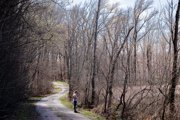
Snake Road
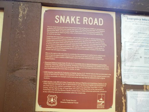
Twice a year, this road is closed off to allow for the migration of thousands of snakes, reptiles and amphibians between cliffs and a swamp.
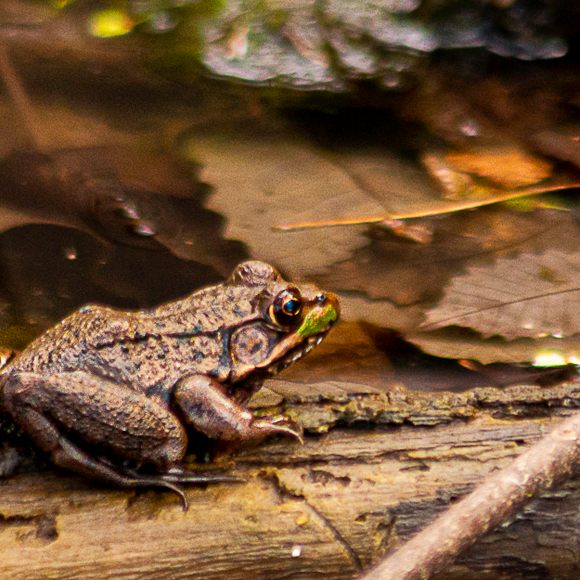
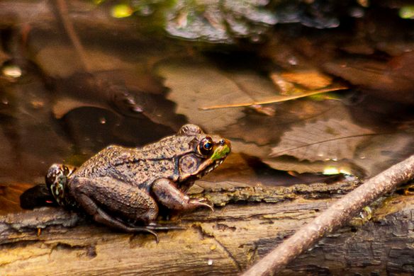

Do you love cavorting with snakes, frogs, salamanders and other reptiles and amphibians? Would you like to explore the natural habitats of these creatures and observe their behavior as they migrate between their winter lairs and summer playgrounds? Well then, the “Snake Road” in southern Illinois should be your destination during the semiannual closure of the road to protect the animals.
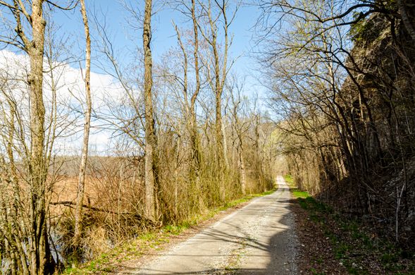
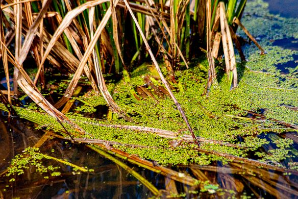
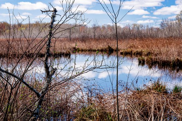
Snake Road, which lies between the sheer cliff faces that long ago helped contain the Mississippi River (one mile to the west) and the swamp left over from when the river shifted and narrowed due to humans channeling the river, attracts people from all over the world. The road is in the Trail of Tears Forest, and every year the U.S. Forest Service closes the road from March 15 to May 15 for the snakes to travel from the cliffs to the swamp, and again from September 1 to October 30, when they return to the cliffs to find dens for overwintering. During the closure, the critters slowly make their way across the one-lane gravel road, often resting in the middle of the lane to bask in the sun or attract a mate.
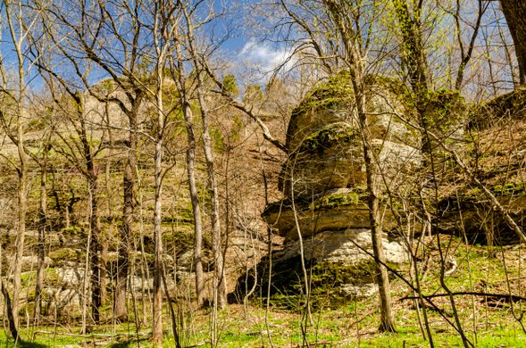
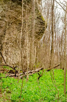
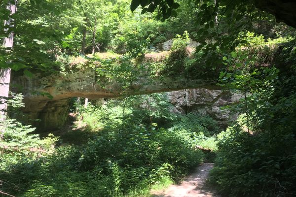
As an added bonus, the cliffs above the swamp, part of the Pine Hills section of the Shawnee National Forest, offer great views of the swamp below, the Mississippi and Big Muddy Rivers and over into the Southern Missouri hills. A short hike out to Inspiration Point is a favorite of visitors to the area. Please resist the urge to dive from the Point into the swamp 350 feet below.
Know Before You Go
There are two entrances into this area. The southern entrance is just north of Wolf Lake, Illinois off of Rt 3 onto LaRue Road. Beware, there is a rail crossing that you must go over that sometimes trains will block for half an hour to an hour while they wait for trains coming from the other direction. When you get to the cliffs, the road is closed off in both directions during snake migration seaon. Park at this turn-around area. The road to your right as you stand looking at the cliffs ends into the swamp and is a dirt road. This area has more fallen boulders and floodplain woods and meadows. Great place for wildflowers.
The northern entrance, and better parking area, is a couple of miles north off of Rt 3 onto Muddy Levee Road, just before you get to the bridge over the Big Muddy River. Follow the levee to the cliffs, then turn right on the access road. There is a parking area here. If you would like to drive up into the Pine Hills area (not the best road in the world, and there is a low-water bridge at the far end, but still easily drivable when the weather has cooperated) to hike out to Inspiration Point (short hike) or just see the vista of the Mississippi River, the Big Muddy River, the flood plains in Illinois, the LaRue Swamp below and over into Southeast Missouri, turn left here, then turn right at the picnic area and drive up the road that climbs the hills. There are numerous pullouts and a picnic area at the top.
NOTE: The handling of wildlife or picking of plants is illegal in this area. Snake hooks, tote bags for snakes, or any other apparatus used in the handling of snakes is prohibited and will most likely end in a fine or arrest.


Follow us on Twitter to get the latest on the world's hidden wonders.
Like us on Facebook to get the latest on the world's hidden wonders.
Follow us on Twitter Like us on Facebook