Trips Places Foods Stories Newsletters
Loading...
Loading...
Loading...
Loading...

No search results found for
“”

Make sure words are spelled correctly.

Try searching for a travel destination.

Places near me Random place

Popular Destinations

  • Paris
  • London
  • New York
  • Berlin
  • Rome
  • Los Angeles
Trips Places Foods Stories Newsletters
Sign In Join
Places near me Random place
All the United States Nevada Yerington Walker River State Recreation Area

Walker River State Recreation Area

Nevada's second-newest state park offers camping, fishing, hiking, and river float trips.

Yerington, Nevada

Added By
slgwv
Email
Been Here
Want to go
Added to list
CAPTION
Entrance gate to the Walker River State Recreation Area.   slgwv / Atlas Obscura User
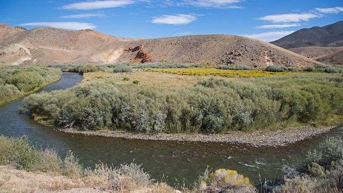
East Walker River in the Elbow, east of the Bighorn Campground site.   slgwv / Atlas Obscura User
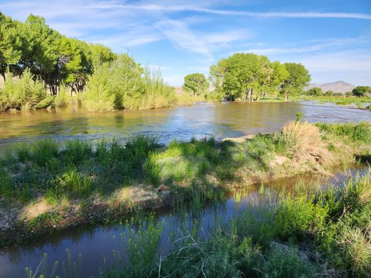
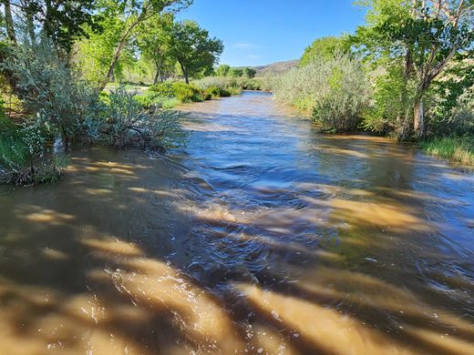
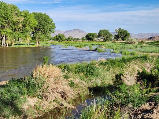
Looking west across the full East Walker River in the Pitchfork Ranch unit, May 2023.   slgwv / Atlas Obscura User
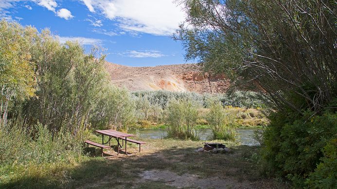
Bighorn Campground at the Elbow   slgwv / Atlas Obscura User
East Walker River at low water, November 2020, off the Nature Trail.   slgwv / Atlas Obscura User
East Walker River at low water, November 2020.   slgwv / Atlas Obscura User
Mule deer off the Nature Trail.   slgwv / Atlas Obscura User
Twin poplars in the Elbow. Trees like this usually mark the site of an old building. In the last year or so the left poplar was undercut and toppled by flooding.   slgwv / Atlas Obscura User
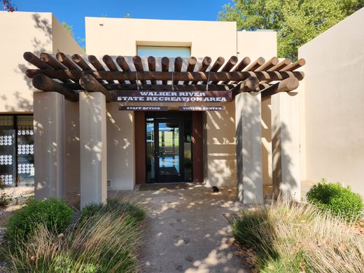
Entrance to the Visitor Center.   slgwv / Atlas Obscura User
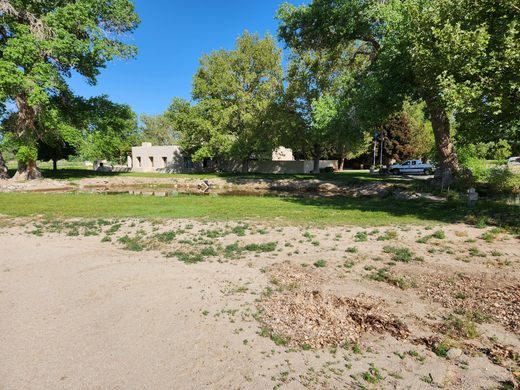
Visitor Center.   slgwv / Atlas Obscura User
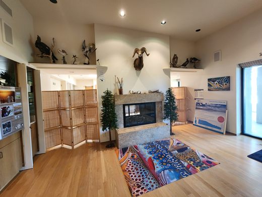
Inside the Visitor Center.   slgwv / Atlas Obscura User
East Walker River near the Elbow.   slgwv / Atlas Obscura User
East Walker River off the Nature Trail at low water, November 2020.   slgwv / Atlas Obscura User
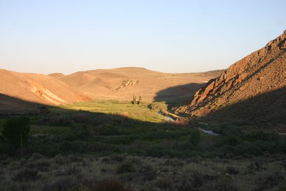
Looking east into the Elbow in late afternoon.   slgwv / Atlas Obscura User
East Walker River at low water, November 2020, off the Nature Trail.   slgwv / Atlas Obscura User
Beaver-gnawed stumps off the Nature Trail, November 2020.   slgwv / Atlas Obscura User
Start of the Nature Trail.   slgwv / Atlas Obscura User
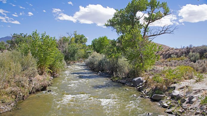
East Walker River running full in May 2023, in the Pitchfork Ranch unit.   slgwv / Atlas Obscura User
East Walker River at low water, November 2020, off the Nature Trail.   slgwv / Atlas Obscura User
Looking downstream (northwest) along the full East Walker River in the Pitchfork Ranch unit, May 2023.   slgwv / Atlas Obscura User
East Walker River at low water, November 2020. Looking westerly; Singatse Range in the distance.   slgwv / Atlas Obscura User
East Walker River floodplain in the recreation area, off the Nature Trail.   slgwv / Atlas Obscura User
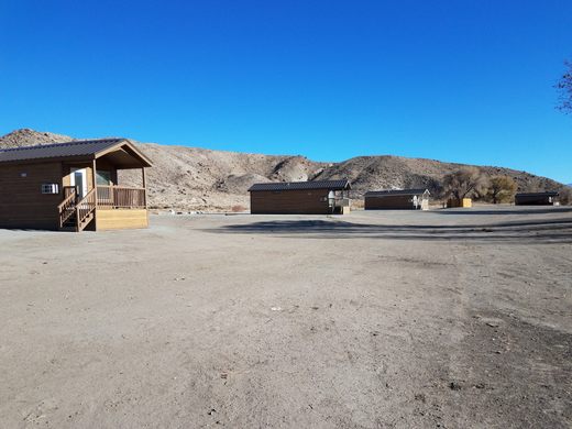
Antelope Acres cabins in the park. These can be rented.   slgwv / Atlas Obscura User
Pass-through gate along the nature trail, to allow access to the river.   slgwv / Atlas Obscura User
East Walker River at low water, November 2020.   slgwv / Atlas Obscura User
Looking east into the Elbow. The twin poplars in the distance probably reflect the site of a dwelling.   slgwv / Atlas Obscura User
Walker River State Recreation Area.   TravelNevada/used with permission
The Elbow. The East Walker River is visible right of center.   slgwv / Atlas Obscura User
Nine Mile Ranch.   TravelNevada/used with permission
East Walker River running full in May 2023, in the Pitchfork Ranch unit.   slgwv / Atlas Obscura User
Been Here
Want to go
Added to list

About

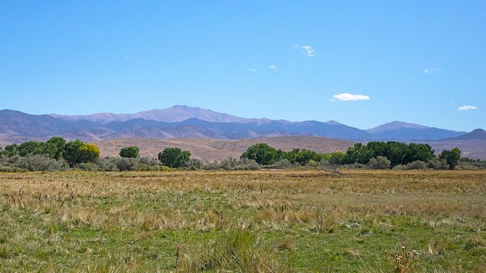
The East Walker River rises in the Sierra Nevada and flows easterly, entering Nevada about 12 miles south of the town of Bridgeport, California. From there it's another 50 miles to its confluence with the West Walker River, at the south end of Mason Valley, where the Walker River begins.

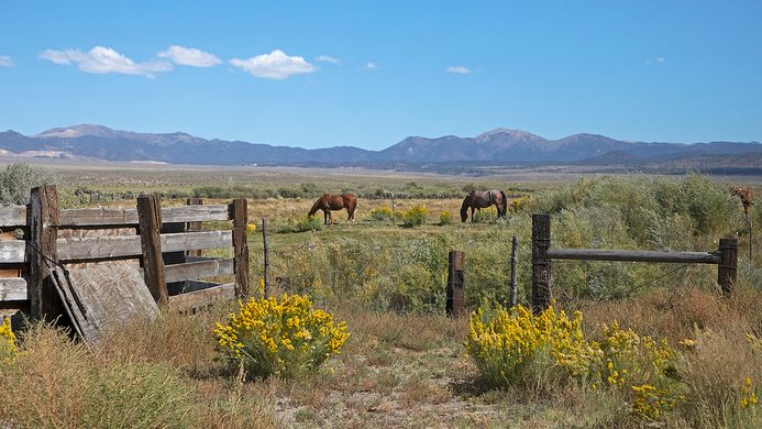
As might be expected, such an abundant water supply in this arid country was rapidly claimed by Euro-American settlers, and for well over a century there has been very limited public access to the East Walker River, most of the shoreline being occupied by private ranches. In the last ten years, though, the Walker Basin Conservancy has acquired a number of these ranches and deeded them to the state to form a state park, with guaranteed public access.

Currently, the main part of the park is at the north end, on the old Pitchfork Ranch, where the visitor center and a couple of campgrounds are located. One campground has RV hookups with water and electricity. A few cabins, the Antelope Acres cabins, are also available to rent. A hiking trail, the Nature Trail, extends along the Walker River for a couple of miles. This area is also popular for river float trips; check the Pitchfork Ranch water trail map for details.

The other open unit is called the Elbow, at the south end of the river not far from the California line. This is a popular fishing area. It includes a primitive campground, Bighorn Campground, with vault toilets but no water or other amenities.

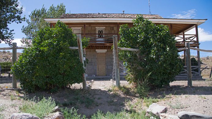
The Rafter 7 Ranch and Flying M Ranch, along the middle course of the river, were also acquired by the state park and will be opened eventually as the property transfer is finalized and infrastructure built. The park also acquired the historic Ninemile Ranch, south of the river on its tributary Rough Creek, near the old site of Fletcher. This ranch includes what is said to be the oldest Euro-American structure in Lyon County and was a Pony Express station briefly. Mark Twain is thought to have visited there, the place being mentioned in Roughing It

Related Tags

Parks Water Rivers State Parks

Know Before You Go

The Pitchfork Ranch Unit is at the southeastern edge of Mason Valley and is straightforward to find. From Nevada State Route 208, which runs on the east side of Mason Valley, turn left on a well-marked turnoff about 38.88130 N, 119.14497 W. It's about four miles to the park entrance, which is marked with an entry gate.

The easiest way to get to the Elbow Unit, which is about 30 airline miles south of the Pitchfork Ranch Unit, is as follows. From the turnoff to the Pitchfork Unit take State Route 208 south and west through Wilson Canyon about 15 miles to its intersection with State Route 338 in Smith Valley. Then follow SR 338 south about 28.2 miles toward Bridgeport, California, and turn left on US Forest Service Road 028. USFS 028 comes in about 2.7 miles before the California line and is signed for "Hawthorne." This junction is at about 38.44262 N, 119.13145 W. From here it is about 5.5 miles to the turnoff (on the left, at about 38.42793 N, 119.04558 W) to the Bighorn Campground. There are various primitive roads accessing the river along here.

It's another seven miles along USFS 028 (which becomes the Lucky Boy Road) to the Ninemile Ranch. The historic ranch building is closed, pending restoration.

The turnoff to Aurora is another 2.3 miles down Lucky Boy Road. It makes an interesting side trip while in the area.

Community Contributors

Added By

slgwv

Edited By

Michelle Cassidy

  • Michelle Cassidy

Published

February 1, 2024

Edit this listing

Make an Edit
Add Photos
Walker River State Recreation Area
211 E Walker Rd
Yerington, Nevada, 89447
United States
38.850336, -119.085561
Visit Website
Get Directions

Nearby Places

Wilson Canyon

Smith Valley, Nevada

miles away

Yerington Pit (Anaconda Copper Mine)

Yerington, Nevada

miles away

Pine Grove and Rockland

Yerington, Nevada

miles away

Explore the Destination Guide

Photo of Yerington

Yerington

Nevada

Places 4

Nearby Places

Wilson Canyon

Smith Valley, Nevada

miles away

Yerington Pit (Anaconda Copper Mine)

Yerington, Nevada

miles away

Pine Grove and Rockland

Yerington, Nevada

miles away

Explore the Destination Guide

Photo of Yerington

Yerington

Nevada

Places 4

Related Places

  • Left Missouri, Right Mississippi

    West Alton, Missouri

    Jones Confluence Point State Park

    Stand at the point where the two mightiest rivers in the United States converge.

  • Geneva, Switzerland

    Pointe de la Jonction

    Where two rivers meet—but don’t mix.

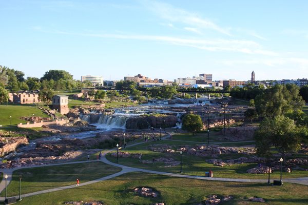
  • Sioux Falls Park

    Sioux Falls, South Dakota

    Falls Park

    More than 7,000 gallons of water pour over these cascading red quartzite waterfalls every second.

  • Wendell, Idaho

    Niagara Springs

    An impressive waterfall nestled in the cliffs of Idaho's Snake River Canyon.

  • The river alongside Larkin Plaza

    Yonkers, New York

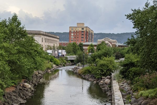
    Saw Mill River Daylighting

    A waterway covered over after the Industrial Revolution has been unearthed and cleaned up, for the enjoyment of fish and humans alike.

  • Lift Pool and Lock No. 1

    Alexandria, Virginia

    Alexandria Tide Lock Park

    Long buried under the 20th-century landscape, this lift lock of the Alexandria Canal is the lone remnant of an ambitious early American transportation project.

  • The headwaters at Lake Itasca

    Lake Itasca, Minnesota

    Headwaters of the Mississippi River

    At this Minnesota state park you can easily wade across the source of the mighty Mississippi.

  • Mossy waterfall

    Gémenos, France

    Parc de Saint-Pons

    A public park off the beaten path with a beautiful waterfall and 13th century Cistercian abbey.

Aerial image of Vietnam, displaying the picturesque rice terraces, characterized by their layered, verdant fields.
Atlas Obscura Membership

Become an Atlas Obscura Member


Join our community of curious explorers.

Become a Member

Get Our Email Newsletter

Follow Us

Facebook YouTube TikTok Instagram Pinterest RSS Feed

Get the app

Download the App
Download on the Apple App Store Get it on Google Play
  • All Places
  • Latest Places
  • Most Popular
  • Places to Eat
  • Random
  • Nearby
  • Add a Place
  • Stories
  • Food & Drink
  • Itineraries
  • Lists
  • Video
  • Podcast
  • Newsletters
  • All Trips
  • Family Trip
  • Food & Drink
  • History & Culture
  • Wildlife & Nature
  • FAQ
  • Membership
  • Feedback & Ideas
  • Community Guidelines
  • Product Blog
  • Unique Gifts
  • Work With Us
  • About
  • FAQ
  • Advertise With Us
  • Advertising Guidelines
  • Privacy Policy
  • Cookie Policy
  • Terms of Use
Atlas Obscura

© 2025 Atlas Obscura. All Rights Reserved.