What’s This Strange Patch in the Australian Desert?
It appeared in the fall of 2015.
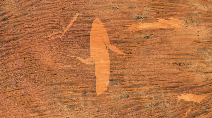
A light patch in the Western Australian desert. (Photo: NASA Earth Observatory)
Back in November 2015, the Landsat 8 satellite passed over Western Australia’s Gibson Desert and captured the image above. That bright orange patch was new—when the satellite had passed the month before, it wasn’t there. Here’s a larger view from October:

October 2015 shot. (Image: NASA Earth Observatory)
And then here’s the same shot from November—you can see the patch towards the bottom of the frame, in the center:

November 2015. (Photo: NASA Earth Observatory)
It looks like a dab of paint in an impressionist painting, or like a whale swimming through an orange sea. But, the NASA Earth Observatory says, it’s a burn scar—a large one.
This area of Australia has long been home to the Pintupi people, who use fires to encourage the growth of certain edible plants or as an aid to hunting, to flush out animals or increase visibility, NASA says. The darker area around the burn scar is grown over with tufty desert grasses; in the bright orange spot, they’re gone.
Once, these fires might have been smaller, but an ecologist in Western Australia has found that as the continent was colonized by the British and nomadic Pintupi people ended up in settlements, the fire scars in the desert grew. If you look at the larger images, they’re all over, though not as fresh as the whale-shaped scar. The change may be due, counterintuitively, to less frequent burnings, because the brush builds up and burns more extensively.


Follow us on Twitter to get the latest on the world's hidden wonders.
Like us on Facebook to get the latest on the world's hidden wonders.
Follow us on Twitter Like us on Facebook